 home |
Caspar: pictorial history
|
|
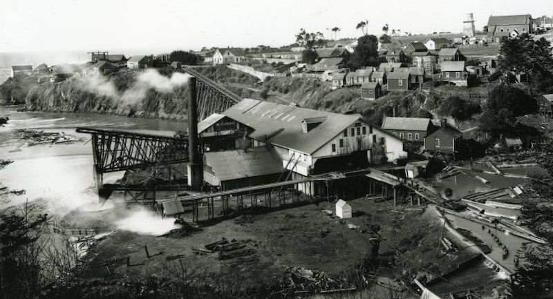 Caspar Mill from Graveyard Hill about 1910. Note all the buildings near the edge of the bluff. |
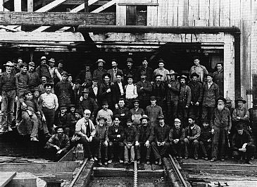 The mill crew in 1904 -- Miles Brothers photo from National Maritime Museum [1]
 The steamship Caspar being loaded from the headlands via the wire chute. Passengers embarked by the same means, riding in the two-benched 'Pullman' visible at right. Photo from Richard Tooker Collection, National Maritime Museum. [1] With heroism and ingenuity, Caspar has always been about people first. By the standards of its day, Caspar's lumber operations were extremely safe, humane, and considerate of the forest and surround. The result is that the headlands today are a fascinating blend of history and nature, pride and nostalgia.  Panoramic image taken in 1911 from the Kelley House collection, retrieved by Matt Buchholz. The steamship SS Earl of Forfar is loading redwood lumber for delivery to the UK. Click here to view the whole panorama (and thank you, Matt!) |
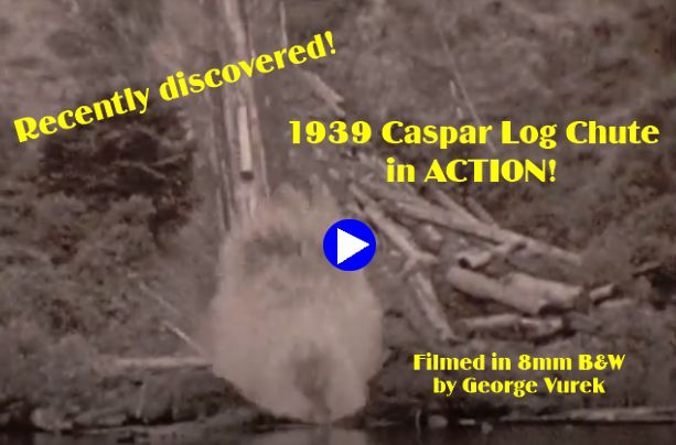
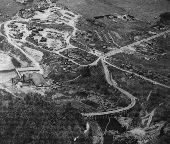
In the 1930s, Caspar was more than a wide spot in the brand new road that would eventually become Highway One that ran through the middle of town and then curved down the bluff and crossed the mill pond on a trestle. As many as 5,000 folks lived here, and the mill and town rivalled Fort Bragg as the largest settlement on the Mendocino Coast. The mill was enormous, handling first growth redwood logs twelve feet in diameter. To support the mill, a railroad network extended east and north, passing across Jughandle creek on an impressive trestle, promptly rebuilt after the 1906 earthquake, and extending as far as Camp One on the north side of what is now Highway 20. The scale of the operation was immense. Many timber industry innovations were pioneered here, including redwood water main and sewer pipe, the double-sided band saw, and the wire chute with which finished lumber was delivered to the decks of the schooners. 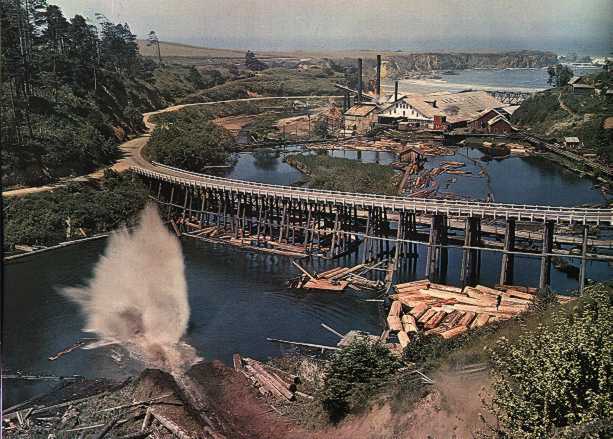 The Mill in 1938 : photo by B. Anthony Stewart © 1939 National Geographic Society [2] The 'big splash' is the result of a log hitting the millpond after sliding down the chute. |
|
In the image at left, orient yourself by finding the Company Store,, center. Follow Caspar Road north (toward 2 o'clock); the first building on the east side is the Lumber Company office and post office. Next to it, what's now the Black Bear building. Across an open space, the Caspar Inn, and beside it the skating rink where Caspar Street now heads east toward Fern Creek. The rink's madrone floor was carefully taken up and has served as the floor for the south room addition to the Community Center (previously the school house, just to the right of the Caspar Foursquare Lighthouse Church – now the Shul – and outside the picture.)
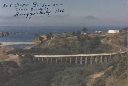 Caspar Creek Bridge in 1966 photo by Harry J. Wakerley |
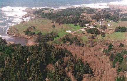 Caspar Headlands in 2000 photo by Sienna M. Potts Caspar was lucky. Prior to 1955, when mill operations ceased, the logging industry was reasonably non-toxic. No virulent chemicals or solvents were spilled here, and the worst residue was bunker oil used to fire the boilers of the steam engines that drove the mill. The headlands did not escape unscathed, however. The topsoil and native flora was scraped off to create flat areas for drying lumber, and massive cement foundations and iron staples were laid and driven into the underlying rock. These remnants will remain on the land for decades, and open a window into the work of generations of woods heroes.
Notes on the pictures: [1] Caspar's logging heritage is documented in the wonderful book Mallets on the Mendocino Coast by Ted Wurm; photographs are used by his gracious permission. [2] The March 1939 National Geographic celebrated the completion of the Golden Gate bridge and the opening of the area of California north of the Golden Gate to exploration by automobile. Prior to that time, roads into the area were crude or non-existent, and most folks traveled by dog-hole schooner or, later, steamer. [3] The aerial photograph at left was taken on 3 March 2000 from a Mooney piloted by Mike Dell'Ara. Thank you, Mike, for a great flight and the smoothest landing ever. text, layout, and explanatory overlay by Michael Potts. |
